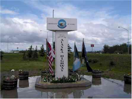
The Alaska Highway
The Alaska Highway (originally called Alcan Highway) was started in March 1942 and completed about nine months later. It was 1523 miles long; running from Dawson Creek, British Columbia to Delta Junction, Alaska. It as originally paved only with gravel and pot holes. It has been improved over the years and is now paved with asphalt and pot holes. However, there is a good deal of road repair going on each summer and there can be long stretches of road that are again gravel (and pot holes).
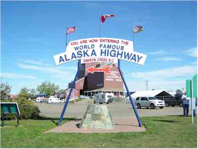
This is the Mile 0 marker in Dawson Creek.
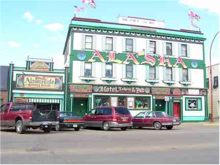
Several old buildings have been restored such as this old hotel. There were even pictures posted on several streets showing what that street looked like in 1942.
There was not much to see in Dawson Creek. One resident was asked what there was to do in the town and he replied "Leave". So we did.
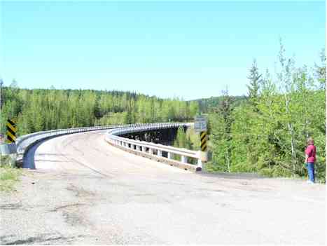
This is the Kiskatinaw Bridge just a few miles out of Dawson Creek. It still lays claim to being the longest, curved wooden bridge in the world.
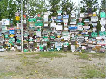
This signboard jungle is in Watson Lake. It was started years ago when someone thought it would be a great idea to put up a sign showing the number of miles and the direction to his home town. Over the years, a number of other people agreed with him and now there are several thousand signs and even a few license plates.
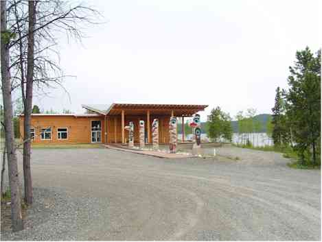
There are many museums and art galleries along the road displaying the culture and art of the native inhabitants. This one is devoted to the Athabascan culture. The totem poles in front of the building were done by a local Athabascan artist.
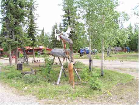
Not all artwork displayed was so serious. This moose displays more of the sense of humor of the artist than his talent. However, there was no mistaking the talent of the baker in the restaurant here. The cinnamon rolls are to die for!
The scenery along the highway, as you might imagine, was varied from one end of the spectrum to the other. Much of it is beautiful, some is unusually beautiful and some is just unusual.
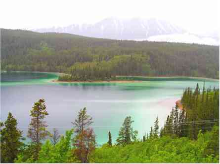
This is Emerald Lake a few miles south of Whitehorse, Yukon. The lake is spring-fed and very clear. The colors come from the absorption effects on the light reflecting from the white sand bottom.
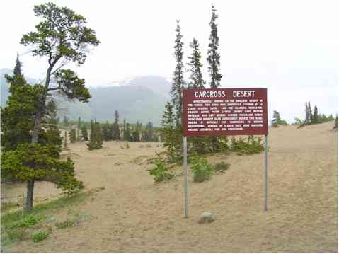
The Carcross Desert lays claim to being the smallest desert in the world. It was originally a glacier lake. The sand left after the lake dried up is constantly stirred by strong local winds such that little can grow here.
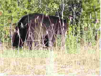
We saw a lot of wild life along the road; more in Canada than in Alaska. This black bear was only a few feet off the road but did not seem to care that we were sharing his space. We also saw moose, caribou, fox, Stone Mountain sheep, and even some wild horses.
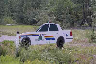
We saw several of these along the Highway. From a distance, it does look like a police car waiting beside the road. I guess even the Royal Canadian Mounted Police have budget troubles.
This is the sign marking the end of the Alaska Highway at Delta Junction, Alaska. We each received certificates attesting to the fact that we had successfully traversed the Alaska Highway. This is a significant achievement even today. The road has been significantly improved but the price of gasoline and cigarettes in Canada was, and is, very painful. Gasoline was $3.00 US per gallon and cigarettes were about $8.00 US per pack.